Mapping the Missing Middle: AI-Based Detection of Mid-Density Housing
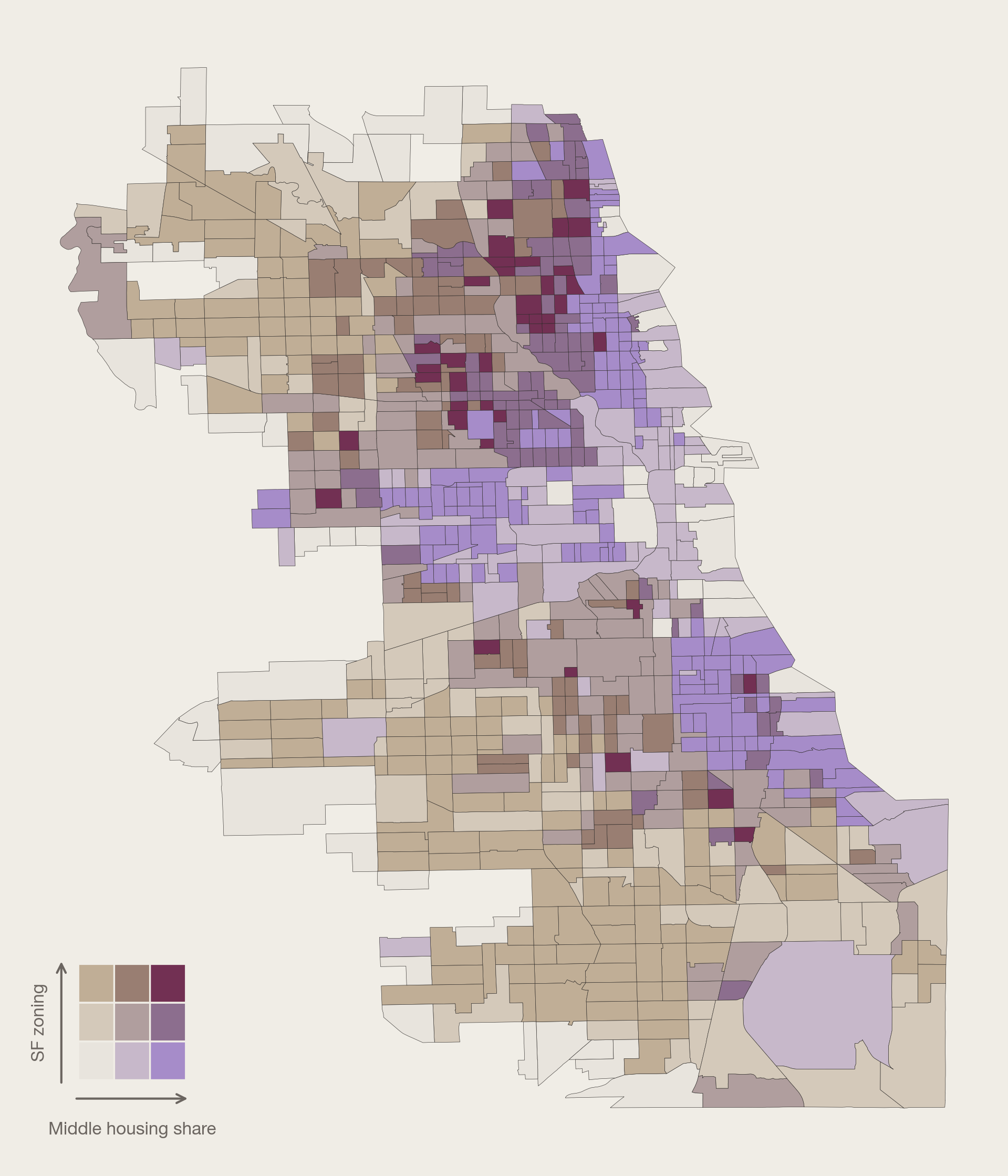
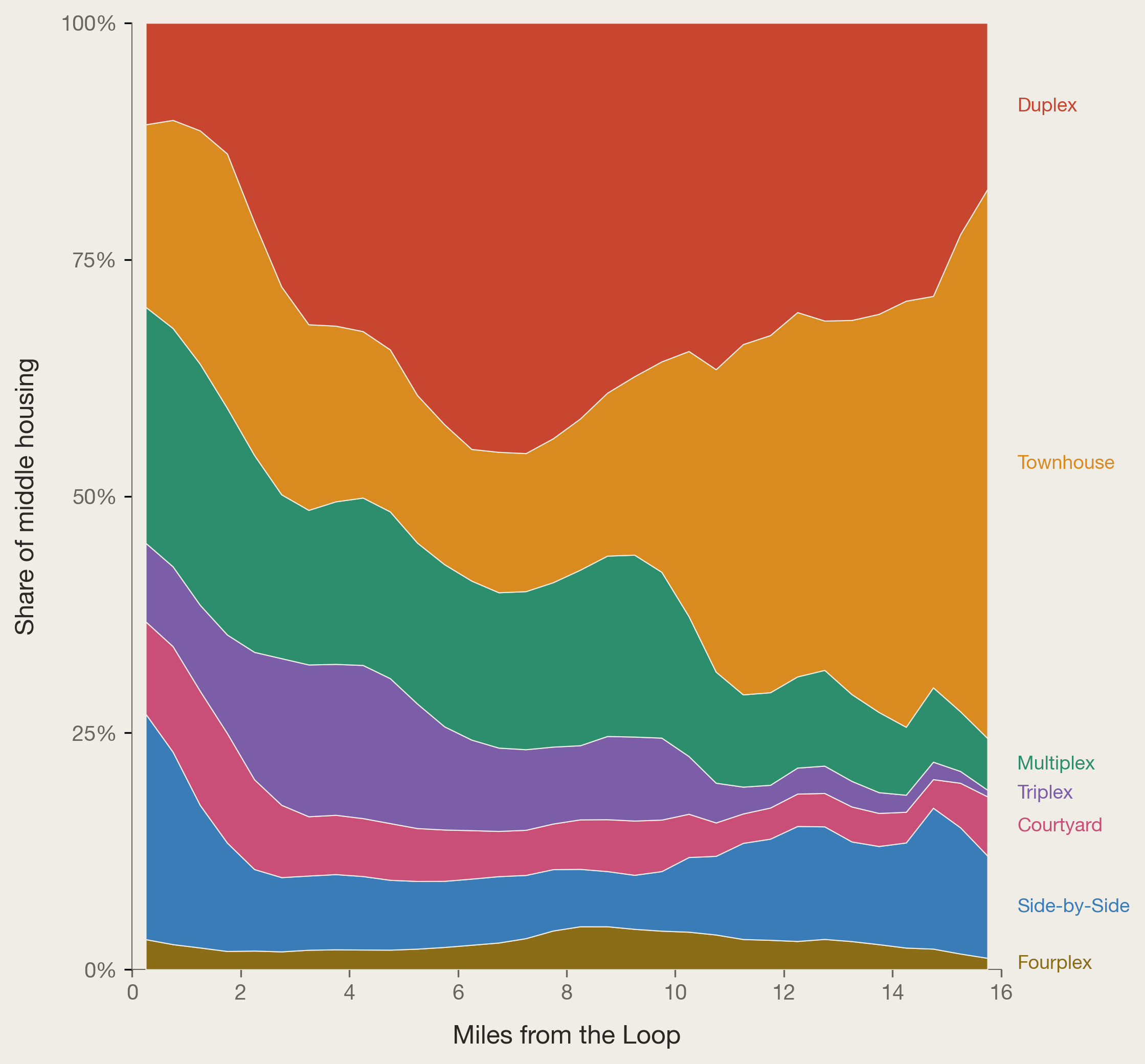
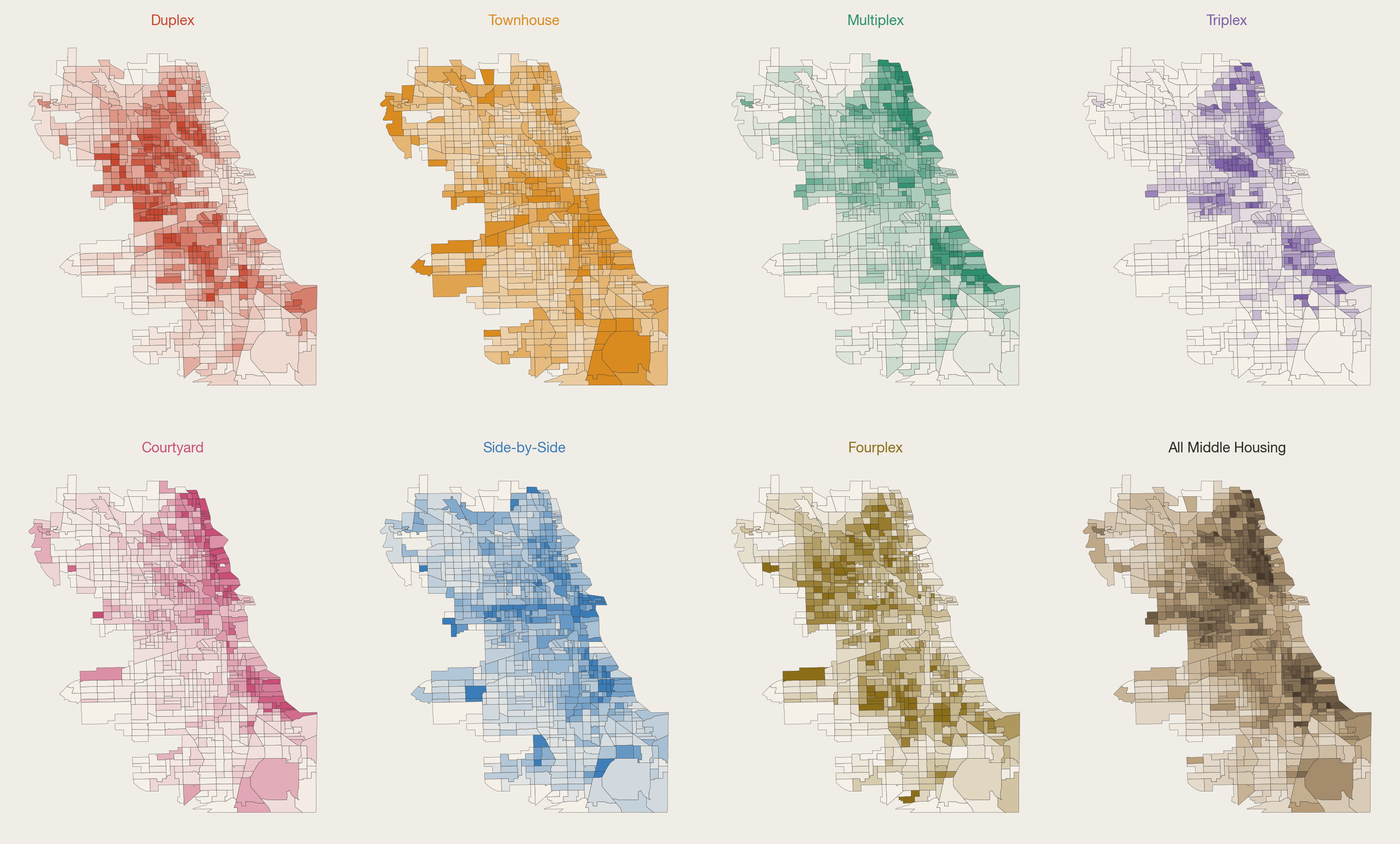
Advocates argue expanding it could ease shortages, improve affordability, and support walkable neighborhoods. However, little is known about its actual prevalence, distribution, or vulnerability because existing data sources either do not identify architectural typology or are confined to individual neighborhoods. We developed a citywide, building-level measure of middle housing in Chicago (IL). We trained an object detection model on Google Street View images and classified building facades into seven middle housing typologies. The model achieved 94% accuracy for binary middle housing classification and 81% for the full eight-class task. We found more than one in three detected buildings in Chicago are classified as middle housing, with duplexes (36%), townhouses (21%), and multiplexes (17%) as the most common forms. Middle housing concentrates in prewar, inner-ring neighborhoods, peaking 3 to 4 miles from downtown. It is found in older neighborhoods with higher home values, and in tracts with higher renter shares and lower rent burdens. Nearly one in three buildings in single-family zoning districts is classified as middle housing, stock that is legally nonconforming and could not be rebuilt under current rules.